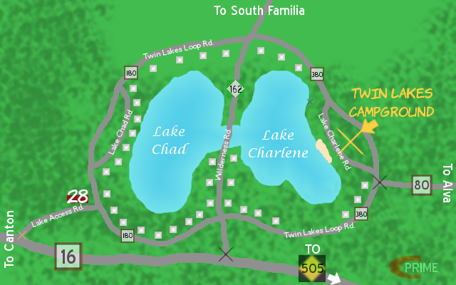
This is the Twin Lakes area (located just south of South Familia). Before Charlene and I moved in, the two lakes were known as "West Lake" and "East Lake". Now they're named after us. The black X's represent Exit Only points while the gold X represents where two-way traffic can flow in or out of the area.
Twin Lakes Campground: Has a total of 120 campsites available to those who wish to camp there, including 80 natural sites and 40 w/electricity. Campgrounds also provide free firewood and showers to campers. There is also a swimming beach located on the west end of the campground. There is NO camp store, although a Mega Gas 'n Gulp is located on Lake Access Rd. near County Road 180 (spot #28 on the map).
The blue X on Lake Charlene represents where a boat launch is located.
Details
Published:
10 years, 11 months ago
10 Aug 2015 19:03 CEST
Initial: 9fb096b99fa85298bd98fb7d0f62aeed
Full Size: 5a492a49e2fd14b57bde63293bada20a
Large: 0fa750aa785ce507d5e40d3fc10fb443
Small: ad9236e9635e4b5933bdc902cdf8ed97
Stats
139 views
4 favorites
0 comments


")