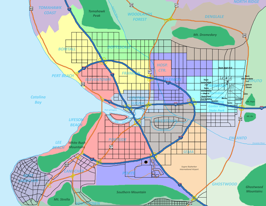
It's still not finished, but here's the map of Sugna, so far. Still needs street and road names for every black line @__@. I'm attempting to give it something of a Rand-McNally look.
If you look toward the left center, you'll see the community of Tavindale, which is where much of McInTots takes place. I've labeled areas of interest; for instance, Splevin-Eleven is the corner store Tay tried to buy Kablazzles from in the Halloween episode of Season 2. JustMart is basically Wal-Mart and it's where the guy tried to tell the kids they'd probably find Kablazzles.
Also, Highway 28 going north is how to get to Camp Pattonhawk, in Stickard County in the next state. The shapes and lines west of where the airport is (Skyharbor) across I-23 is Sugna Gardens (unlabeled), a huge entertainment complex consisting of a sports arena (the big circle), convention center, hotel, and a theme park which integrates with a water park (formerly Aqua Shack, but is going to be MUCH bigger in the future and called Aqua World). The orange line weaving in and out of the place is a monorail system which services the entire complex.
The kids have lots of fun places to see and explore in Sugna and I hope they have fun living there n__n
This map isn't just laid out randomly; it's a sort of combination of Houston, TX and Phoenix, AZ as I viewed them growing up in each, that goes especially true for Tavindale and how the grades are separated amongst the schools.
The final version will most likely find itself in one of the books.
Details
Published:
13 years, 7 months ago
29 Dec 2011 22:34 CET
Initial: b1080d98279cfd0787e7fa6d4d401ef9
Full Size: b1e516dc909f6b0c28a423247855e0dc
Large: 26aa87a7139b4880e89c82e8632373ab
Small: 20b5859fdee1c1fcbb9174ad13a3d534
Stats
349 views
6 favorites
26 comments
